
Printing is not supported at the primary Gallery Thumbnail page. Please first navigate to a specific Image before printing.
-

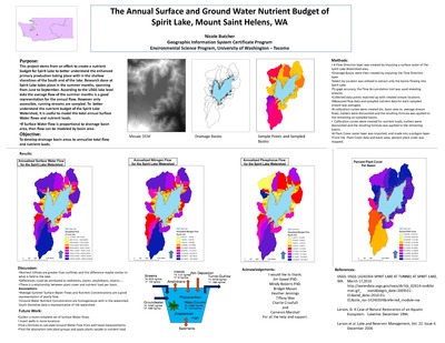
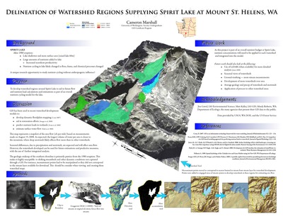
Delineation of Watershed Regions Supplying Spirit Lake at Mount St. Helens, WA
Cameron Marshall
2008


